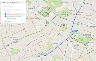
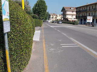
Perugia è sempre una città bellissima per un turista, anche se è facile perdersi tra vicoli e scalette; inoltre, come in molti casi, alla cura del centro storico non corrisponde una uguale cura della periferia: basta allontanarsi appena dalle mura per trovarsi senza marciapiedi e senza cartelli indicatori.
Being unemployed (again), I have decided to 'take a rest' by attending a workshop about crowdmapping, at Università per Stranieri in Perugia. The plan was to relax for two days in a beautifull town, learning something usefull and having fun with maps. Two goals accomplished out of three is good enough.
Perugia is a stunning place for a tourist, a bit too easy to get lost because of maze-like passages and hidden stairways; moreover, as in many cities, a tidy city center is encircled by less tidy outskirts: as you step outside the old town you find yourself deeply in need of sidewalks and directions.
 |
| Perugia |
Ma torniamo al corso. L'obiettivo era di insegnarci i rudimenti dello story map con un approccio pratico, facendoci inserire dati sui siti UNESCO in Italia e creando brevi storie legate ad essi.
Story map significa raccontare una storia tramite una mappa: un viaggio, un movimento culturale, un fenomeno sociale possono essere raccontati più efficacemente attraverso una mappa in cui inserire foto, video, testi, eventualmente informazioni tratte da diversi social network.Esistono diversi strumenti software per realizzare una storia tramite mappa, ma al corso è stato affrontato solo il software della ESRI: Story Maps. Non solo, di tutte le versioni disponibili è stata presentata solo quella che la docenza aveva deciso di utilizzare per il workshop (Map journal). Un workshop non è un corso, ma mi sarei aspettata una esposizione più esaustiva: se stai facendo pubblicità alla ESRI, almeno falla fino in fondo, presentandomi lo strumento nella sua interezza.
But let's get back to the course. The goal was to give us some instructions about story map, allowing us to create stories about UNESCO's italian sites.
Story map means to tell a story using a map: a journey, a cultural movement, a social phenomenon can be told way better by using a map where you can add photos, videos, texts, data from social networks.
There are different softwares that allow you to create such a story, but the course was only about ESRI software: Story Maps. Moreover, only one of the many ways you can build a story has been explained (Map journal). A workshop is not a course, but I would have expected a more exaustive explanation: at least, if you are advertising for ESRI you should do it properly, showing me everything Story maps can give.
 |
| Uno strumento che avrei gradito mi fosse presentato / A tool I wished that was shown |
Se lo scopo è davvero il crowdmapping, cioè l'inserimento di informazioni geografiche da parte di utenti qualsiasi, sarebbe meglio usare una piattaforma in cui chiunque possa inserire dati, invece di permettere ai soli frequentanti del corso di intervenire.
E perchè fare inserire dati in modo casuale, senza una struttura logica e scegliendo informazioni in modo arbitrario? Tutto quello che ci è stato chiesto è stato: inserire il poligono del sito (inventandoselo), inserire punti per gli aspetti culturali del sito, inserire punti per i rischi presenti (inventandosi anche questo). Tutto molto arbitrario. Certo, è un lavoro svolto in modo gratuito da degli utenti, e sarebbe indelicato lamentarsi...
E visto che il workshop era gratuito, nemmeno io posso lamentarmi di non aver imparato tutto quello che avrei voluto imparare.
The point was to have us mapping at least part of UNESCO sites in Italy. But during the presentation of the course they have said that UNESCO has the sites' polygons: why should we draw polygons randomly? I do not know the file format of UNESCO's polygons but I am fairly sure they can be converted and add to a map on line.
If the point is to do crowdmapping, meaning geographical data add by anyone on internet, it would be better to create a website where everyone can add data, instead of having data add only by the few persons that have taken the course.
And why giving us no logical structure for the database, choosing data in the web on random base and personal taste? All they have asked us was: a polygon of the site (invented), some points for the cultural aspects of the site, some points for the hazards put to the site (invented as well). Everything is heavily random. Surely they cannot protest for the quality of the results of free work.
And as the workshop was free as well, I admit I cannot complain for learning less than I expected.
Valutazione di Map journal.Premetto che dovrei riguardare attentamente tutte le informazioni disponibili sul sito della ESRI, per ora solo in inglese (se qualcuno volesse un traduttore, ricordo che sono attualmente disoccupata); la valutazione che segue si basa sulle sole informazioni ottenute dal workshop.
Per creare una story map è necessario per prima cosa creare la base geometrica di poligoni, punti e linee che verrà poi arricchita dai contenuti multimediali nella seconda fase del lavoro.
La base geometrica può essere creata tramite ArcGIS sul proprio computer, per poi essere caricata on line. Se fosse necessario modificare la geometria sarebbe necessario correggere la mappa sul proprio computer e caricarla nuovamente: non è possibile caricare le correzioni come, appunto, correzioni, ma solo come nuova mappa, perdendo l'eventuale lavoro fatto on line. É evidente che questa procedura è molto farraginosa: non capisco perché non sia possibile creare geometrie sulla mappa, come ad esempio si fa con Google Maps. Si consideri che un software ArcGIS richiede almeno 4 giga di RAM, perché è un software di analisi topologica, non un Paint qualsiasi per fare disegnini.
Una volta caricata la mappa, l'inserimento di informazioni da internet è abbastanza semplice, anche se meno immediato rispetto ad altri strumenti on line. Inseriti tutti i contenuti, è possibile creare il diario (journal) vero e proprio: la struttura è simile a un PowerPoint, in cui lo sfondo delle slide è una mappa dinamica in cui l'utente può zoomare, spostarsi e cliccare sui vari elementi. Le varie slide presentano inquadrature diverse della mappa, creando la storia vera e propria.
Review of Map journal.
As foreword, I should have a good long look at tutorials and information on ESRI's web site, by now only in english (if anyone would like some translation, I am currently unemployed); the following review is based only on the informations I got at the workshop.
To create a story map, the first thing you need is a geometry of polygons, points and lines, this will be enhanced by contents on-line in the second phase of the work.
This geometric base can be created using ArcGIS on your computer, than it is uploaded on the web. If you need to change the geometry, you have to change it on your computer and upload it again, you can not upload corrections as corrections, but only as a new map, loosing the work you have done on-line on the map. Such procedure is quite distressing: I cannot understand why I can not draw geometry on Story Maps, as I can do, for instance, on Google Maps. Remember that ArcGIS needs at least 4 giga of RAM, because it is a software of topological analysis, it is not a mere Paint to draw doodles with.
Once you upload your map, you can add data from the web, it is a bit less easy than other web sites. As you have all your data together, you can create the actual journal: it looks a bit like PowerPoint, every slide has a embedded dynamic map, the user can zoom, pan and click on the features to see the contents. The slides shows different views of the map, telling the actual story.
L'idea di raccontare storie su mappe è sicuramente interessante ma, almeno per quanto ho potuto capire da questo workshop, c'è molta strada da fare in termini di usabilità e comprensione del software.Se ESRI vuole entrare nel mercato della rete 'sociale', dove gli utenti sono inesperti e hanno poca voglia di spendere, forse dovrà semplificare il software. In alternativa potrà rimanere quello che già è: ditta leader nel settore analisi geografica e fornire lo strumento di story map come una ulteriore possibilità di marketing ai propri clienti (paganti).
Ultima nota al corso: forse il nome scelto è poco calzante, più che un workshop di crowdmapping è stato un workshop di story map. Il crowdmapping è un altra cosa, e se ne parlerà in un'altra occasione...
Telling stories with map is very interesting but, basing my judgement on what I have learned in this workshop, there is a lot of work to do about software usability.
If ESRI wants to step in 'social web' market, where inexperienced users not willing to spend money rule, maybe it will have to develop something easier. Else, it can remains what it is: the main software house in geographic-based software and give story map to (paying) clients as a way to spread their contents in the market.
Last comment about the course: maybe the name was not carefully chosen, it was less a workshop about crowdmapping and more about story map. Crowdmapping is quite different, and will be told about another time...


